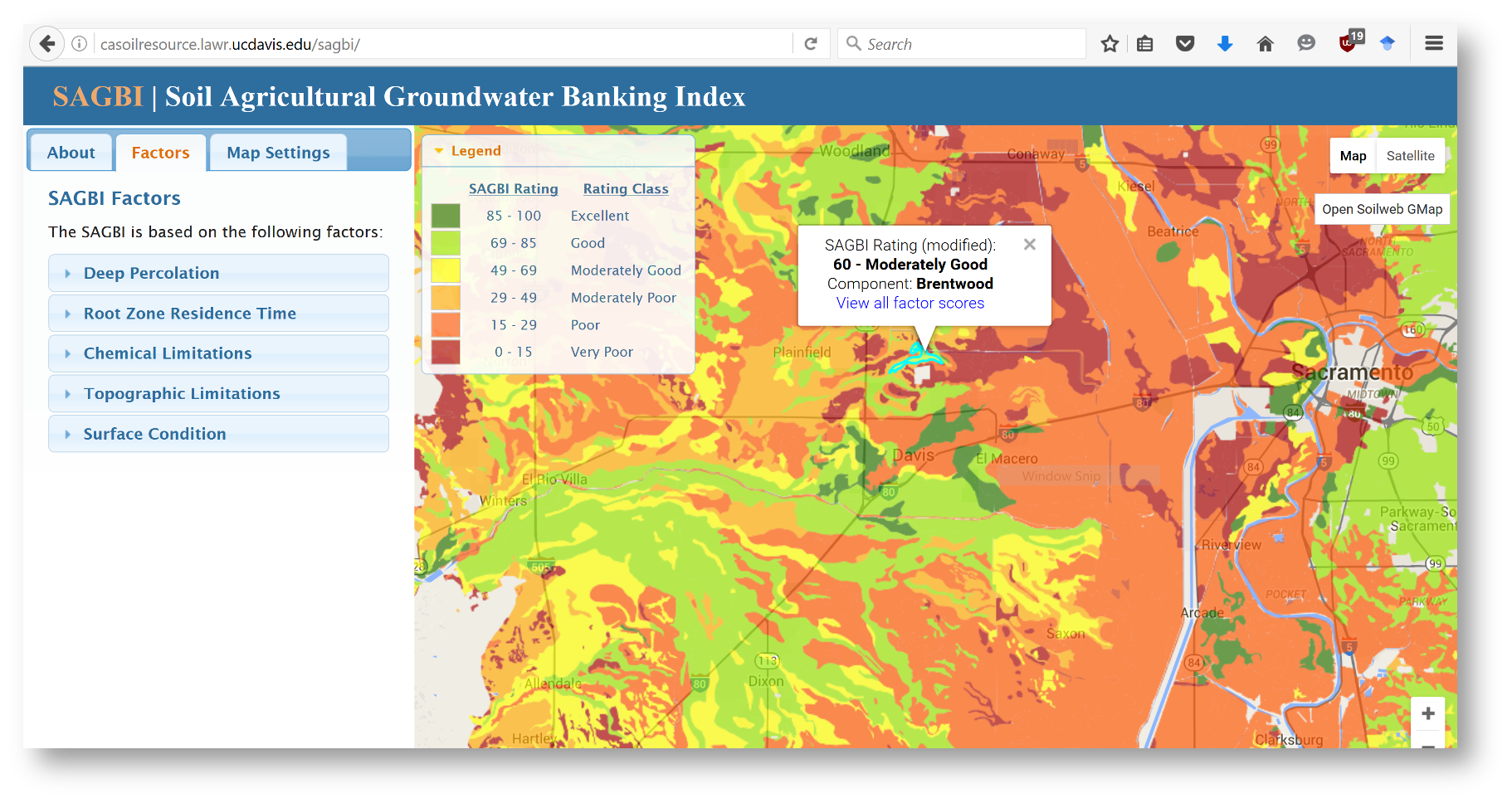
Decision support tool to identify soils suitable for groundwater recharge.
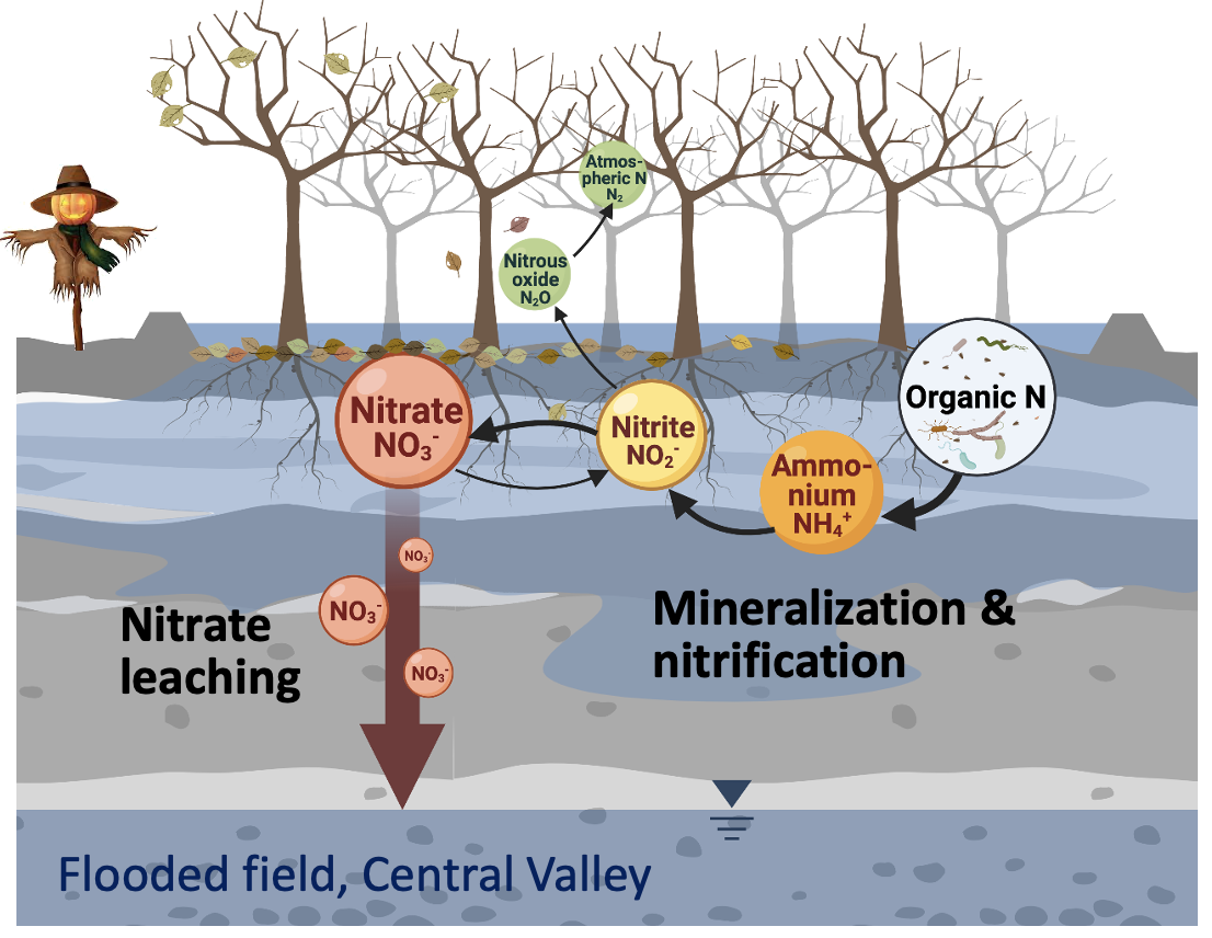
Nitrogen loss pathways and nitrogen transformation processes during AgMAR
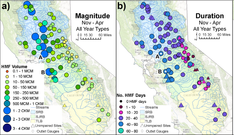
High-magnitude flow availability for groundwater recharge.
Managed aquifer recharge in agricultural landscapes
Groundwater has become an increasingly important source of water supply, particularly in regions with irrigation agriculture. Intensive groundwater withdrawals have caused numerous problems, including: depletion of streams, irreversible reduction of aquifer storage, need to pump from deeper aquifers, exacerbated seawater intrusion, and compromised groundwater quality, to name a few. Concurrently, many groundwater-dependent regions experience significant flood events.
My research team and I aim to lead the field in groundwater recharge strategies for agricultural regions. A key focus of our research is to capture excess floodwater for agricultural managed aquifer recharge (AgMAR), a technology that takes advantage of large sections of agricultural land to recharge winter runoff not stored or used before ocean discharge for reliable multi-year aquifer storage. Successful implementation of this strategy provides an opportunity to mitigate both flood damage and groundwater depletion problems while sustaining water supply for food production.
Watershed Hydrology
Headwater watersheds are critical for provision of a wide range of ecosystem services, including terrestrial and aquatic habitat, flood mitigation through storage of water, and the majority of drinking water supplies throughout the world. Understanding climate and human impacts in headwater catchments is important for ensuring their hydrological and ecological functions and services. We are investigating long-term changes in catchment response to various climatic and anthropogenic drivers to better understand how these factors influence the storage and release of water in these systems.
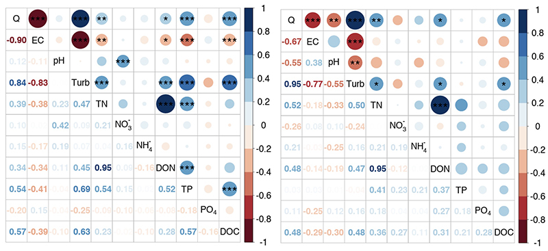
Correlation plot of major water chemistry parameters in Caspar Creek watershed.
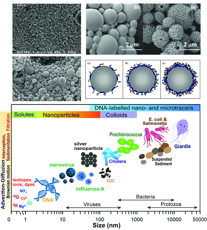
DNA tracer technology and particle transport
Over the past century hydrologists and scientists from related disciplines have repeatedly grappled with questions such as: Which flow paths does water take to the stream? How long does water reside in the landscape? How do interacting flow paths influence contaminant transport and stream water quality?
Our lab is using synthetic DNA either in its free form or encapsulated in polylactic acid (PLA) or poly(lactic-co-glycolic acid) (PLGA) as environmental tracer to map numerous, contemporaneous water sources and flow pathways. Using DNA has the advantage that an unlimited number of possible DNA sequences of nearly the same fate and transport behavior can be fabricated, which makes it one of the best tracers to identify the connectivity between multiple sources and multiple sinks, and to identify the inputs from the same source at different times.